Watch beach huts getting swept out to sea as Hastings and St Leonards battered by high winds
and live on Freeview channel 276
Videos taken from Hastings show waves crashing against the rocks and sweeping onto the promenade.
In St Leonards, the high winds caused waves to smash against the beach huts, even dragging a few further out to sea.
Advertisement
Hide AdAdvertisement
Hide AdHastings Pier was closed on Sunday as winds were expected to reach speeds of 46mph, amid a threat of 'strong winds and thundery showers'.
According to the Met Office, gusts reached 36mph, while persistent rain fell throughout the day.
Heavy rain set to continue
After a dry start to Monday (September 30) a heavy band of rain arrives later with the Met Office predicting another six hours of heavy rain right throughout the evening
And there is no let up tomorrow (Tuesday) with more rain and thunderstorms predicted throughout the day,
Advertisement
Hide AdAdvertisement
Hide Ad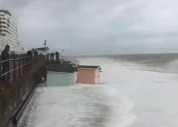

Today, cloud will gradually be thickening from the west towards midday, with outbreaks of rain spreading east from early afternoon, turning heavier into this evening. Freshening coastal winds. Maximum temperature 18 °C.
There are flood warnings across the UK with forecasters fearing we will feel the effect of Hurricane Lorenzo later in the week.
Hurricane Lorenzo, a maximum Category 5 storm, is the most powerful hurricane ever recorded so close to Europe.
But while Western England could catch the tail-end of it, forecasters say the South East should not be so badly affected.
Advertisement
Hide AdAdvertisement
Hide AdMet Office forecaster Steven Keates said: “Lorenzo is a real beast of a storm. It will be one of Europe’s strongest ever tropical storms, as the Azores are part of Europe.
“After reaching the Azores on Tuesday, Lorenzo is expected to move to the UK by Thursday - bringing a couple of days with potentially worse conditions than this weekend.”
Video supplied by Ellie Bee